
While we have so many fascinating pictures of deep space as revealed by our sophisticated telescopes, a NASA Scientist named Will realized that we do not have enough pictures of Earth from space. Launching a satellite into space to take pictures of Earth from space is too expensive.
“Satellites typically cost about $1 Billion per satellite,” Will stated during an Interview session with Nas Daily.
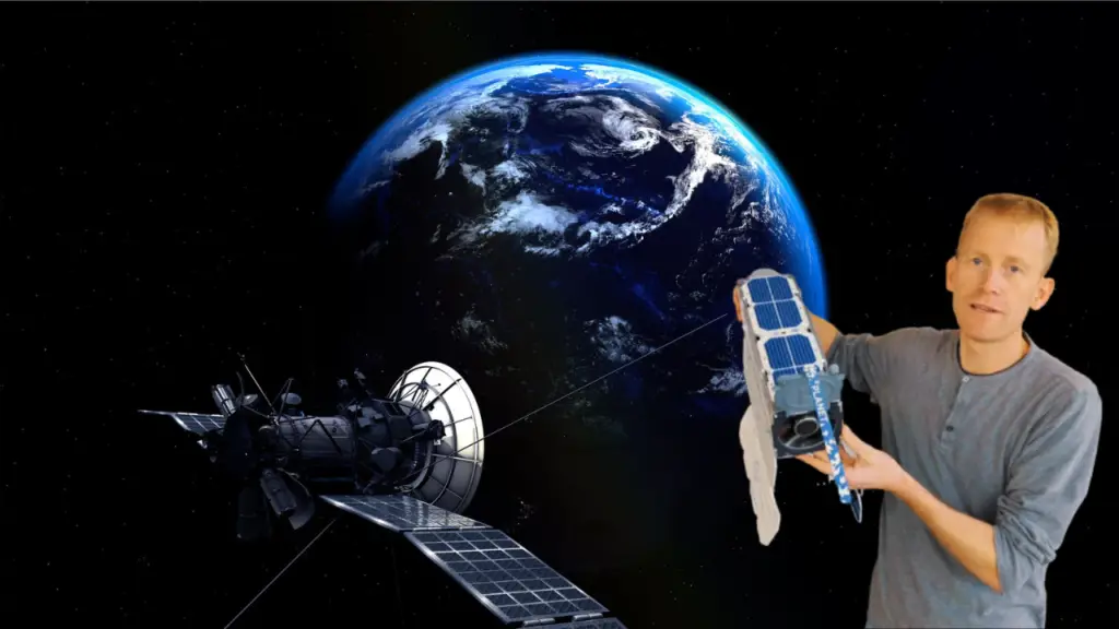
Because of the expensive cost of launching satellites into space, many people are not buying into the idea. However, Will was motivated to take pictures of earth from space. He collaborated with his friends to invent a satellite that is about the size of a loaf of bread and about a thousand times cheaper than a traditional satellite. The satellite built by Will and his team has a sophisticated camera system, solar arrays, a powerful telescope system that passes through the middle of the satellite, and other components.
Currently, Will and his team have successfully launched more than 200 of these satellites orbiting around the earth. The telescope system installed in these satellites points down towards Earth and takes fascinating images of our home planet. They take images of billions of trees, mountains, houses, trains, roads, oceans, seas, and the entire planet.
What these Satellites Discovered from taking Pictures of Earth from space Every Single Day

After launching 200 of these sophisticated satellites, Will and his team began to take pictures of Earth from space. These images enabled scientists to discover the impact of global warming on Earth. They went further to reveal that the corals are dying, oceans are drying up, and deforestation and other hazards are caused by humans to nature.

Images captured from these satellites are helping the world to notice the severe damages we are causing to mother nature. Our ability to discover these damages fast enough will help us to protect our home planet and preserve it for the next generation. Since we now have real-time data provided by these 200 satellites, we can easily track damages coming to our home planet before they impact us greatly.
Conclusion
Will and his team used these satellites to take about four million pictures of Earth from space every day to enable humanity to save it. In the future, we should be expecting more of these satellites to ensure that we are not contributing immensely to climate change. What are your thoughts about Will’s invention and contributions to the way we view our home planet from space?


Impresive
Were can l see the pictures